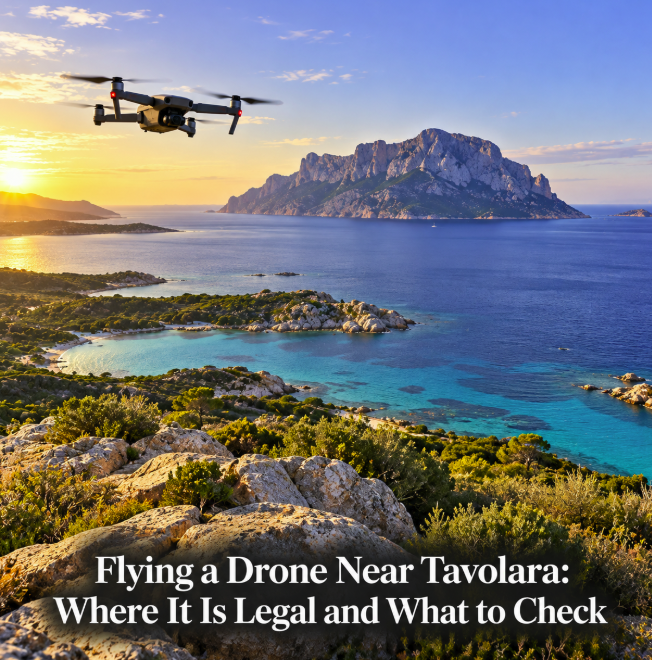
Tavolara is one of northeast Sardinia’s most spectacular subjects for aerial photography, but choosing a beautiful take-off point is not enough to make a drone flight legal. The island and much of the surrounding coast lie within the Tavolara–Punta Coda Cavallo Marine Protected Area, while the wider Olbia area is also affected by aviation restrictions. For recreational visitors, the correct approach is to check the exact launch point and intended flight area on Italy’s official D-Flight map immediately before every flight rather than relying on an old online map or a list of supposedly legal beaches.
ENAC, Italy’s civil aviation authority, states that UAS operators must verify the geographical zone on D-Flight before each individual operation. The map displays restrictions created for airport safety, security and environmental protection, and those restrictions can determine whether an Open-category flight is permitted, limited to a particular altitude or prohibited.
Do not assume Tavolara itself is a normal drone location
The Tavolara–Punta Coda Cavallo Marine Protected Area covers a sensitive marine and coastal environment around Tavolara, Molara and stretches of the mainland coast. Its management authority publishes zoning and regulations for activities within the protected area.
ENAC explains that protected natural areas can also be subject to UAS geographical zones when the relevant restriction has been approved and published on D-Flight. ENAC further notes that the national mapping of some protected-area restrictions is undergoing revision, which makes live map verification particularly important.
The marine protected area also has its own authorization system. Since January 2026, the Tavolara management authority has operated a unified online portal for activities requiring authorization within the protected area, and its current information specifically lists video and photographic filming among activities handled through the authorization process.
For an ordinary visitor, this means that “I am outside the airport” or “my drone weighs under 250 grams” is not sufficient evidence that a flight over Tavolara or the protected coastline is legal.
Where should you look for a legal Tavolara viewpoint?
The most practical strategy is to look for mainland viewpoints outside any restricted geographical zone shown on D-Flight while keeping Tavolara in the distance as the photographic subject. The coastline south of Olbia offers many visual angles toward the island, but the legal status can change over relatively short distances because of environmental and aviation zones.
Instead of naming a beach as permanently “drone legal,” open D-Flight and inspect the precise location on the day of the flight. Check both the point where you intend to stand and the entire airspace through which the drone will travel. A legal take-off point does not authorize you to fly into an adjacent restricted area.
This is particularly important around Porto San Paolo, Capo Coda Cavallo, San Teodoro and the coast facing Tavolara. These places offer superb views, but proximity to the marine protected area means a photographically attractive spot should never be treated as automatic permission to fly.
Olbia Airport creates another layer of restrictions
Tavolara is close to Olbia Costa Smeralda Airport and its surrounding controlled aviation environment. ENAC states that geographical zones established for airport safety can prohibit Open-category UAS operations, with D-Flight using different mapped sectors and altitude limits.
That is why simply moving a few kilometers toward Olbia to obtain a different angle may not solve the problem. Airport-related restrictions can be more important than the marine-park boundary. D-Flight is the authoritative operational map to consult for the specific coordinates.
Basic Open-category rules still apply
Even in an area where D-Flight allows an Open-category flight, the general European and Italian UAS rules remain in force. ENAC states that Open-category pilots must remain below 120 meters from the nearest point of the surface, maintain visual line of sight and avoid flying over assemblies of people. Required safety distances from uninvolved people depend on the applicable Open subcategory and the drone being used.
ENAC also requires UAS operators to complete the appropriate D-Flight registration and obtain the European operator identification code where applicable, carry adequate insurance and ensure that the remote pilot has the competence required for the operation.
A small drone therefore does not create a blanket exemption from airspace restrictions. Weight can change training and operating requirements, but geographical zones still matter.
Be especially careful on busy beaches
Northeast Sardinia’s beaches can become crowded in summer. ENAC emphasizes that drones must not fly over assemblies of people and must maintain the safety distances required by the applicable category. A beach that appears usable at sunrise may become unsuitable once swimmers and visitors arrive.
For photography, an early flight can therefore have practical advantages: fewer people, softer light and often calmer visual conditions. But sunrise does not override a D-Flight restriction, protected-area rule or local access limitation.
What if D-Flight shows a red or restricted zone?
Do not interpret a red area as an invitation to fly low and hope for the best. ENAC explains that Open-category operations are prohibited in geographical zones established for aviation safety. Some red zones created for other reasons can allow operations only after obtaining the required clearance from the entity responsible for the restriction, depending on the conditions published for that zone.
If an operation cannot be conducted in the Open category, it may fall into the Specific category, which involves additional risk assessment and authorization procedures. That is generally beyond what a tourist needs for casual holiday footage.
A safer way to plan the shot
Start with the composition you want: Tavolara rising behind turquoise water, a rocky mainland foreground or a broad coastal panorama. Then use D-Flight to identify a permitted area from which that view can be obtained without entering restricted airspace. Confirm the altitude limit, nearby people and property, take-off access and the entire planned flight path.
Check again shortly before launch. D-Flight publishes current UAS geographical-zone information, including validity periods, applicable rules and contact information where relevant. Temporary restrictions can matter even if you have flown from the same place before.
If the desired viewpoint falls within a protected or otherwise restricted zone, contact the relevant authority rather than assuming that a recreational flight is permitted. The Tavolara–Punta Coda Cavallo Marine Protected Area currently provides an authorization portal and contact channel for activities requiring permission.
The best legal drone viewpoint near Tavolara is therefore not one fixed coordinate that can safely be recommended forever. It is a mainland location that gives you the view you want while D-Flight confirms that your exact operation is permitted under the rules in force that day. Around one of Sardinia’s most environmentally sensitive and aviation-constrained coastlines, checking the map is part of getting the shot.