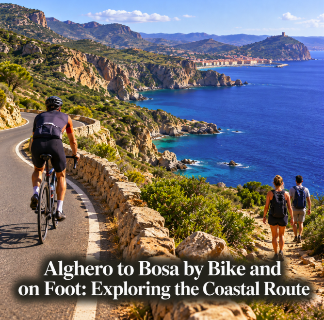
The coast between Alghero and Bosa is often described as a 45-kilometre coastal route, and the number is broadly correct. What can be misleading is the word “path.” There is no single continuous 45 km pedestrian trail following the shoreline from one town to the other. The famous through-route is primarily the spectacular SP105/SP49 coastal road, officially promoted for cycling and widely regarded as one of Sardinia's classic road-bike journeys. Hiking is better approached as a series of shorter coastal walks and access trails rather than an attempt to walk the entire provincial road.
For cyclists, the official Sardegna Ciclabile network lists the Alghero–Bosa itinerary at 49.2 km from Alghero station to Bosa station. Italia.it describes the coastal cycling itinerary as roughly 50 km and a medium-difficulty one-day ride. For hikers, the same coastline offers beaches, cliffs and side trails, but road traffic and long stretches without a separate footway make a continuous road walk a poor interpretation of the route.
The cycling route: Alghero to Bosa on the SP105
Leaving Alghero toward the south, the road quickly moves away from the urban waterfront and begins following a wild section of western Sardinia. The SP105 later becomes the SP49 as it approaches Bosa. Touring Club Italiano describes the scenic road as just under 45 km between the towns, while the regional cycling itinerary measures 49.2 km when station-to-station urban sections are included.
The difference is therefore mostly about where you start and finish. For planning purposes, think of the ride as approximately 45–50 km.
Sardegna Ciclabile currently classifies the route as difficult in its itinerary summary and reports that almost 80 percent uses shared road rather than dedicated cycling infrastructure. The listed surface is predominantly asphalt, with a smaller portion of stabilized unpaved surface in the broader planned cycling itinerary.
This is not a family cycle path separated from traffic. The attraction is the road itself: curves above the sea, long views across the western coast and an increasingly isolated landscape between the two towns.
How demanding is the ride?
Distance alone makes the route look manageable, but the coastline is not flat. The official Sardegna Ciclabile sheet gives an average gradient of around three percent, and commercial cycling itineraries commonly report substantial accumulated climbing over the full stage.
The road rises and falls repeatedly, particularly around the more rugged central section. Wind can add significantly to the effort. A strong headwind from the wrong direction can make 50 km feel much longer, while summer heat can turn exposed climbs into an unpleasant challenge.
Italia.it rates the ride as medium difficulty, while Sardegna Ciclabile's route page flags the current itinerary as difficult. Those descriptions are not necessarily contradictory: a fit road cyclist may find it a satisfying half-day ride, while an occasional holiday cyclist can find the combination of hills, traffic and exposure demanding.
An e-bike can make the climbing more accessible, but it does not solve the road-safety issue. Riders still need confidence sharing a narrow, winding provincial road with motor vehicles.
Why north-to-south is popular
Touring Club Italiano recommends traveling from Alghero toward Bosa so that the sea remains on the right-hand side. This direction gives cyclists and motorists the coastal side of the road for much of the journey and makes the sequence of views especially satisfying.
It also produces a natural finish in Bosa, where the colorful old town rises beside the Temo River. After several hours on an exposed coast, arriving among cafés, buildings and services feels like a genuine destination rather than simply a turnaround point.
Direction should not override weather, however. Check the wind forecast before committing. On a very windy day, the more favorable direction may matter more than keeping the sea on a particular side.
What you see along the way
The southern coast of Alghero quickly becomes less developed. Cala Burantino lies beyond the city, followed by the area around Poglina. Farther south, the landscape becomes increasingly rugged around Capo Marrargiu, an area associated with Sardinia's griffon vultures.
Approaching Bosa, coastal places include Compoltitu, Torre Argentina, Cala 'e Moro and Cane Malu. Not every cove is a simple roadside swimming stop: access conditions vary, and some require walking on rough ground.
The route is therefore better treated as a landscape journey than as a checklist of beaches. Stopping at every possible cove can turn a manageable cycling day into a very long one.
Can you hike all the way from Alghero to Bosa?
Technically, a determined long-distance walker can devise a route between the towns, but visitors should not confuse that with a continuous signed coastal hiking trail. Much of the famous 45 km corridor is a provincial road shared with cars, motorcycles and cyclists.
Walking long sections of a narrow scenic road is not the same experience as hiking a purpose-built coastal path. Bends, limited shoulders and traffic visibility need to be considered. For most visitors, shorter hikes from established access points are a more enjoyable way to experience this coast on foot.
This distinction is important because online descriptions sometimes use “route,” “coastal road,” “bike route” and “trail” interchangeably. Official cycling sources are clear that the Alghero–Bosa through itinerary is primarily a cycling corridor.
A better bike-and-hike strategy
If you want both cycling and walking, divide the experiences rather than forcing them into one continuous trek. Ride the Alghero–Bosa road as the main journey and reserve time for one or two short walks from safe stopping points.
Near the Bosa end, Torre Argentina and the coves around Compoltitu and Cane Malu provide opportunities to leave the road and explore the coastal environment on foot. Around Alghero, separate walking routes and urban/coastal cycling infrastructure offer easier outings before tackling the more demanding road south.
Do not lock an unattended expensive bicycle at an isolated roadside pull-off and disappear for hours. If you are combining riding and hiking, plan equipment security in advance or use an organized transfer or supported tour.
Water, food and mechanical preparation
The central section between Alghero and Bosa is sparsely developed. Alghero's official destination guide warns cyclists not to expect shops along the coastal road and notes that the road is narrow and shared with vehicles.
Carry enough water for the conditions, plus food that can survive heat. In summer, start early rather than relying on a late-morning departure. There may be beautiful sea below you without any convenient place to refill a bottle.
Bring a spare tube or tubeless repair kit, pump or inflator, basic multitool and charged phone. Mobile reception can vary along rugged coastal sections, so download your route before leaving.
A rear light is sensible even in daylight on a road with bends and changing light. Bright clothing and predictable road positioning help drivers see you earlier.
Best season for cycling
Spring and autumn are generally the most comfortable seasons for this ride. Alghero's official destination guide specifically suggests March to June and September to November for the coastal cycling route.
Summer offers long daylight but introduces heat, stronger tourism traffic and the risk of starting a climb when the sun is at its most intense. If you ride in July or August, an early departure becomes much more important.
Winter can provide beautiful clear days, but rain, wind and shorter daylight need to be assessed individually. The west coast is exposed to weather coming from the open Mediterranean.
Getting back after a one-way ride
A one-way Alghero-to-Bosa ride requires a return plan. Do not assume that a regional bus will automatically accept a full-size bicycle: vehicle capacity, bicycle transport rules and schedules can vary.
The simplest solution for many visitors is a prearranged bike transfer, a supported cycling service or an itinerary that includes luggage and bicycle logistics. Another option for strong riders is a loop returning through the interior, but that substantially increases distance and climbing and should be planned as a separate route.
If renting a bike in Alghero, ask the rental company before departure whether it offers Bosa collection, one-way rental or transfer services. Confirm the arrangement rather than relying on an informal promise.
Bike or hike?
If your goal is to experience the full Alghero–Bosa coastline in one day under your own power, cycling is the natural choice. The official route exists, the distance is realistic for an active cyclist and the road's changing elevation is part of the experience.
If your goal is quiet walking beside the sea, choose selected sections instead. A 45 km through-hike along the provincial road sacrifices much of what makes coastal hiking enjoyable and introduces unnecessary exposure to traffic.
The best interpretation of this famous west-coast journey is therefore not a single 45 km “coastal path.” It is a spectacular 45–50 km cycling road between two historic towns, surrounded by shorter opportunities to explore cliffs, coves and Mediterranean scrub on foot. Understanding that distinction makes it easier to plan the trip safely—and much more likely that the day will feel like an outdoor adventure rather than a battle with the road.