Sardinia looks extraordinary from above: limestone cliffs, secluded turquoise coves, sandy beaches and winding coastlines. Bringing a drone for aerial photos sounds tempting, but can tourists actually fly one? Yes, drone flying is possible in Sardinia where permitted, but you must comply with European and Italian aviation rules and check restrictions for the exact location before every flight. A quiet beach is not automatically a legal take-off point or flight area.
Are drone laws in Sardinia especially strict?
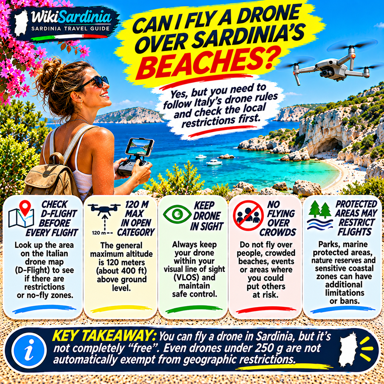
Sardinia follows the European Union drone framework administered nationally by ENAC, Italy’s civil aviation authority. These rules apply to recreational as well as commercial flying, with obligations determined by the operation, drone classification, location and risk. Additional geographical restrictions may apply near airports, in security zones and in environmentally sensitive areas. The most important mistake is assuming that a remote cove is unrestricted simply because there are few people around.
Check D-Flight before every flight
Italy’s official drone geographical-zone information is available through D-Flight maps. Before flying, identify the exact planned take-off and flight area and read all applicable restrictions, including altitude limits, prohibitions and any authorization requirements. Conditions can vary over short distances and may change. The drone manufacturer’s built-in geofencing map is not a substitute for checking the Italian rules.
ENAC explicitly requires operators to verify geographical zones and airspace compatibility before each flight. See ENAC’s official guidance on UAS geographical zones.
What are the basic rules for recreational drone flights?
For operations in the EU open category, the general height limit is 120 metres from the closest point of the earth’s surface, unless a lower local limit applies. The drone must remain within visual line of sight, and flights over assemblies of people are prohibited. Additional rules govern distances from uninvolved people according to the drone’s class and operational subcategory. You must fly safely and respect privacy. A beautiful beach packed with swimmers is not a suitable place for a casual overhead drone flight.
Official source: ENAC: limitations in the open category.
Can you fly a drone under 250 grams?
A sub-250g drone may have simpler pilot-training requirements, but it is not exempt from no-fly zones, privacy rules, safe-operation requirements or restrictions over crowds. If a lightweight drone has a camera and is not classified as a toy, operator registration is generally required. In Italy, ENAC also requires suitable third-party liability insurance for drone operations. Check the drone’s class and the exact applicable conditions before travel.
For the category distinctions, consult EASA’s open-category guide and ENAC’s general open-category requirements.
Do tourists need to register or obtain a drone licence?
Operator registration is generally required for camera-equipped drones unless a specific exception applies. Residents of an EASA member state normally register as operators in their state of residence; that registration is recognized across participating states. Visitors from outside the EASA system should review the registration procedure applicable to them before flying in Italy. Pilot competency certificates are required for some classes and subcategories, while certain sub-250g operations do not require a pilot exam. Registration, insurance and competency are separate obligations: satisfying one does not automatically satisfy the others.
Can you fly over beaches in protected parks?
Not automatically. National parks, marine protected areas, nature reserves and other sensitive coastal locations may be subject to geographical flight restrictions and separate conservation or access rules. A marine protected area designation does not, by itself, tell you the exact drone restrictions for every coordinate. Check D-Flight and any additional requirements of the relevant park or managing authority. This is particularly important for iconic destinations and wildlife-sensitive coastal habitats.
What about the Gulf of Orosei and hidden coves?
Places along the Gulf of Orosei can be visually spectacular, but steep cliffs, strong winds, boats and difficult recovery options add practical risks. A cove being hidden or accessible only by boat does not make it legally unrestricted. Confirm the exact airspace status, local land-access rules and any conservation restrictions before planning aerial photography. Do not launch from a crowded boat or fly beyond a headland where you can no longer see the drone.
Can you fly near airports or helicopter routes?
Airports, heliports and other aviation facilities can trigger geographical restrictions. Helicopters may also operate near the coast for emergency response. Always give way to crewed aircraft and never fly near emergency operations. If the official map shows restrictions, do not assume you can bypass them by remaining low or flying only for a minute.
Can you film swimmers and sunbathers?
Respect people’s privacy and avoid recording identifiable individuals without an appropriate legal basis. Flying directly above crowded beaches also raises safety concerns and is prohibited over assemblies of people in the open category. If your goal is a clean landscape image, choose a lawful location and time when people will not be disturbed or put at risk.
What should you check before packing your drone?
Confirm your drone’s class and weight, operator registration, identification requirements, pilot qualification if needed and insurance. On the day, check D-Flight, weather and wind, people nearby, take-off and landing permissions, and whether you can maintain visual contact throughout the flight. When in doubt about an authorization, do not launch until the competent authority has clarified the position.
The WikiSardinia takeaway
You can capture spectacular aerial views in Sardinia only where the specific flight is legally permitted and safe. The general open-category rules include a 120-metre height ceiling, visual line of sight and no flights over crowds, while local geographical zones can impose stricter limits or bans. Even small camera drones must respect those restrictions. Before every flight, check the official D-Flight map and follow ENAC guidance. The best drone shot is one that protects both the people and the place you came to admire.