On a map, Sardinia looks compact enough to cross in a couple of easy drives. Two villages may appear separated by only a short stretch of countryside, yet the journey can involve mountain passes, winding roads and a surprising amount of time behind the wheel. Why do driving times between Sardinian towns often feel so much longer than the distance suggests?
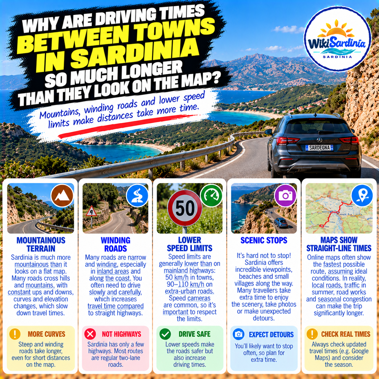
The main reason is simple: distance on a map is not the same as distance along a road, and road distance is not the same as driving time. Sardinia combines fast regional routes with narrow, curving roads that follow the contours of hills and valleys. Add summer traffic, parking and tempting viewpoints, and a seemingly short trip can take up a significant part of your day.
Sardinia is more mountainous than many visitors expect
The island is famous for beaches, but much of its interior is hilly or mountainous. The Gennargentu massif, the rugged Supramonte and numerous smaller ranges create a landscape in which the shortest line between two towns may cross steep terrain, deep valleys or protected natural areas. Roads often have to curve around these obstacles instead of running directly from one place to another.
A village may look close to another on a flat screen while the actual road must climb, descend or loop around a ridge. This is especially noticeable when travelling between inland settlements or between a coastal resort and a destination just beyond the mountains.
Winding roads change everything
Many of Sardinia's most beautiful roads are full of bends. On a straight, well-engineered road, a driver can maintain a relatively steady speed. On a winding mountain road, safe speed changes constantly with visibility, bends, road width and gradients.
These roads can be spectacular, but they require concentration. Even a short stretch with repeated hairpin turns can take much longer than a similar distance on a major road. Trying to compensate by driving faster is dangerous and can spoil the trip.
There are fast routes, but they do not go everywhere
Sardinia does have important high-capacity roads. The SS 131 Carlo Felice forms a major north–south connection between the Cagliari area and the Sassari–Porto Torres area, while the SS 131 d.c.n. provides a significant connection towards Nuoro and Olbia. Other important routes include the SS 125, which passes through landscapes that vary from easier modern sections to notably winding stretches.
However, a fast main road may only cover the first part of a journey. The final kilometres to a village, beach or archaeological site can involve smaller roads, reduced speeds and slow access through built-up areas.
What about speed limits?
Italy's ordinary road rules apply in Sardinia. General limits vary by road classification and conditions, and posted signs can impose lower limits. Visitors should not assume that a road permits the same speed as a motorway simply because it appears wide on a navigation app.
Mountain curves, junctions, village streets, roadworks and poor visibility may require driving well below the posted maximum. A speed limit is a ceiling under suitable conditions, not a target to reach on every bend.
Does Google Maps underestimate Sardinian driving times?
Not necessarily. Navigation services calculate routes using the road network and available information; they do not simply draw a straight line between two towns and divide by a fixed speed. Their estimates can be useful for normal point-to-point driving.
What often surprises travellers is the gap between the estimated moving time and the real time needed for the outing. A navigation estimate may not include finding a parking space, walking from a distant car park, stopping for photographs, waiting at a busy beach entrance or taking an unplanned detour. Traffic and road conditions can also change after the estimate is made.
Summer traffic can slow coastal journeys
During the busiest holiday weeks, roads leading to popular beaches and resort towns may experience congestion. The final approach to a beach can be particularly slow when parking is limited or access is controlled. Even if the main part of the journey is quick, the last few kilometres can be frustrating.
Travel early where practical, check any reservation or access requirements for the destination and avoid building a tight itinerary around an exact arrival minute.
Scenic stops are part of the experience
There is another reason driving in Sardinia takes longer than expected: you may actually want to stop. A panoramic viewpoint, a quiet village square, a roadside bakery or a sudden glimpse of turquoise water can easily turn a direct transfer into a half-day excursion.
This is not a transport problem; it is one of the pleasures of travelling through the island. But if you have a ferry, flight or timed reservation to catch, keep sightseeing stops separate from the essential journey.
Why can two nearby beaches be far apart by road?
On the coast, headlands, cliffs and protected natural areas can prevent a direct road connection. Two coves might be close across the water but require a long drive around a peninsula or through the hills. Some beaches are accessible only by footpath or boat, so the road journey may end well before the destination itself.
Always check the actual access point, not just the beach name on a map. A route to the nearest road may still leave a significant walk.
Are roads in Sardinia dangerous?
Many routes are perfectly manageable for attentive drivers, but unfamiliar roads demand care. Narrow sections, limited visibility, wildlife, cyclists, agricultural vehicles and sudden weather changes can all affect the journey. In rural areas, animals may occasionally be near or on the road. Avoid rushing and do not assume that every bend has the same safe speed.
Night driving on unfamiliar mountain roads can be more demanding because visibility is reduced. If you are uncomfortable with that kind of driving, plan longer transfers during daylight.
How should you plan a Sardinian road trip?
Start with the route suggested by your navigation app, then add a realistic allowance for stops, parking and access to the actual attraction. The right margin depends on the road and the purpose of the trip: a major-road transfer is different from a beach day involving mountain roads and a walk from the car park.
For a relaxed holiday, group attractions geographically and avoid trying to visit distant corners of the island on the same day. Choosing a few well-positioned accommodation bases can save hours of driving and leave more time to enjoy the places you came to see.
Should you trust the shortest route?
The shortest route in kilometres is not always the quickest or easiest. Navigation apps may offer alternatives using major roads or smaller local roads. Compare the estimated times and road characteristics, especially if you are driving a large rental vehicle or travelling with passengers who dislike winding roads.
Before setting out, check current traffic and any road closures through your navigation service and official road information. The road network changes, and no static travel article can promise an exact journey time for every date.
The answer
Sardinian towns can take longer to reach than they look on a map because the island's hills, mountains and coastline make roads curve, climb and detour. Fast regional routes help on some journeys, but many destinations still require slower local roads. Navigation estimates are useful, yet they do not always capture the full time needed for parking, sightseeing and seasonal congestion.
The best advice is not to drive faster: it is to plan fewer stops per day, allow flexibility and treat the journey itself as part of discovering Sardinia.